
A waterfall visit near Mentone can mean a look at the upper falls, a descent to a railed viewing platform, or a hike toward the basin. Those are different plans—not successive steps that everyone has to complete. If you are learning Lookout Mountain while considering a move, choose the view that fits your day before choosing the parking area.
The most useful distinction is easy to miss: the picnic-area overlook reached by stairs is not the same route as the separately named Overlook Trail. Here is how to choose between them, read the distances correctly and leave room for a worthwhile alternative.
Featured image: an original hiking-preparation illustration, not a photograph of a Mentone property, trail or viewpoint.
Choose a view, not just the name “DeSoto Falls”
Alabama State Parks describes the dam and upper falls as accessible to visitors of all abilities, while the main waterfall overlook involves about 50 concrete stairs. Its current Falls page calls the picnic-area side view the easiest option, the separate Overlook Trail moderate, and the River Trail moderate to strenuous. “Easiest” is a comparison, not a promise of step-free access to the main view.
Decide first whether stairs belong in your outing at all. A descent that feels manageable at the beginning still leaves a climb back. If the upper area is your choice, let it be the destination; you do not need to make the platform or basin the measure of a successful visit.
Read trail mileage as one way, and keep the routes separate
| Option | What the published route entails | How to use that distinction |
|---|---|---|
| Upper dam and falls | Upper-area visit; not the main lower overlook | Start here when avoiding the stair descent is important. |
| Picnic-area side overlook | Approximately 50 concrete stairs to the platform | Choose a viewpoint visit with a return climb, rather than a trailhead hike. |
| Overlook Trail | 0.45 mile one way; about 0.9 mile if returning the same way | Front high view; the map explicitly says this trail does not descend to the basin. |
| River Trail | 0.70 mile one way; about 1.4 miles if returning the same way | A steep descent toward the river, then upstream to the basin; allow for the return climb. |
Trail figures and route relationships come from the park’s Falls Picnic Area and Trailhead map. The return figures above simply double its one-way distances; they do not include wandering around, parking-area walking or a combined route. The map also shows a Bluff Trail branching from the River Trail. It is not an invitation to improvise a shortcut between viewpoints.
For example, someone who wants a front view but does not want the basin descent can investigate the Overlook Trail, rather than assuming that “overlook” means the paved picnic-area approach. Someone wanting the basin should plan the River Trail as the outing itself. Neither distance alone tells you how long your group will take.
See the difference between a view and a descent
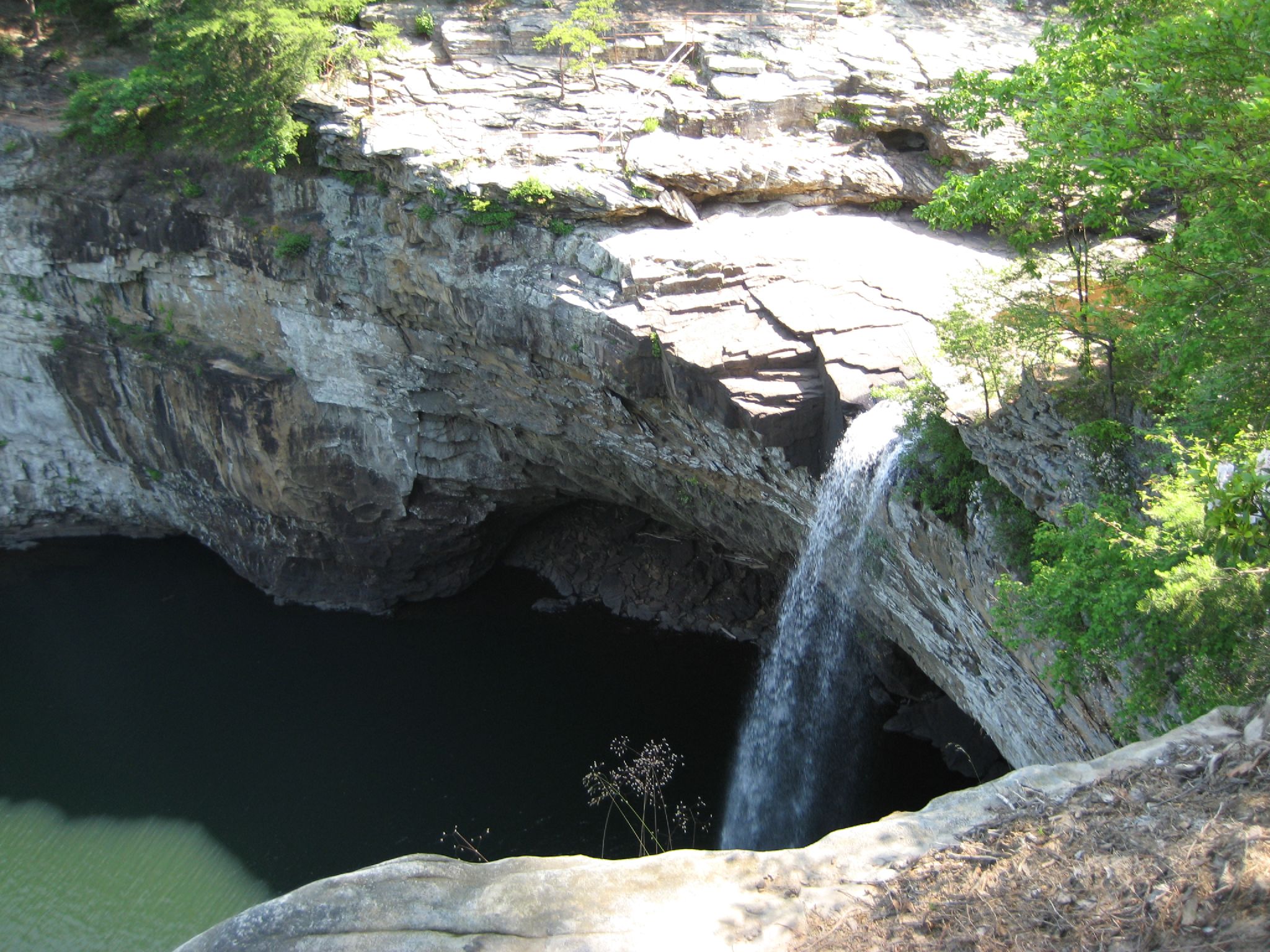
Use the photograph for physical context, not navigation. Follow the marked public routes on the operator’s map; the map specifically cautions against crossing private property. A visible rock shelf, bank or gap in a photograph is not an authorized route. For navigation, save the linked map before leaving rather than trying to reconstruct a path from a scenic image.
Make parking and the vehicle part of the choice
The current Falls page lists $5 per vehicle, daylight opening and dusk closing. Parking can fill on weekends; there is no overflow or roadside parking, and RVs and trailers cannot access the area. Cell service may be unreliable. That makes a passenger-car outing a different proposition from a detour with a moving trailer.
The linked map still prints a $4 fee dated March 2020. Use the current operator page for the $5 parking figure checked October 26, 2026; use the older map for orientation, then follow current signs and closures. A downloaded PDF can remain useful without every printed detail remaining current.
A full lot is a decision point, not a parking puzzle to solve on the shoulder. Have a separate destination in mind or return another time. If you are working around a home showing or a fixed appointment, choose an outing you can comfortably abandon rather than treating access as guaranteed.
The park publishes written driving directions for the main park and Falls. Use the section for your actual destination: the Falls directions appear separately from the main-park approaches. The document cautions larger vehicles about mountain gaps; it does not override the Falls restriction on RVs and trailers. Avoid turning a moving-day route into a sightseeing experiment.
When a woodland walk fits better than waterfall stairs
The main DeSoto State Park area is seven miles from the Falls picnic area, according to the park’s trip-planning page. Treat it as a separate destination, not the next section of the same walk. The main park does not have a general gate or entrance fee; that is distinct from Falls parking.
One specific alternative is the Talmadge Butler Boardwalk Trail. The official hiking page describes a 360-yard boardwalk suitable for people of all abilities, ending at a deck over the pool at Azalea Cascade. This is a woodland-and-cascade experience, not another way to see the main DeSoto Falls. If surface condition or an individual access requirement is decisive, ask park staff about that route specifically.
That gives you a useful choice before the drive: a Falls viewpoint, a deliberate rugged hike, or a boardwalk visit at the main park. The same hiking page recommends appropriate closed footwear, water and finishing before dusk. Packing for the activity you actually selected is more useful than arriving prepared only for a photograph.
What the outing can teach you about a Mentone-area home search
“Near outdoor recreation” becomes more meaningful when you name the experience you want to repeat. Is it a short stop with visiting friends, a regular woodland walk, or a more demanding hike? Try that specific trip from the address you are considering, including the return journey. A home’s map position cannot establish whether its driveway, your usual vehicle and your preferred outing fit comfortably together.
Keep those observations separate from claims about the property. A pleasant visit does not establish road maintenance, utilities, a legal access right or a guaranteed travel time. It can, however, help you explain what you want from your next home in concrete terms. For the wider set of destinations, my Fort Payne outdoor routine guide compares DeSoto with Little River Canyon and includes a regional orientation map.
Conclusion
For a first DeSoto Falls visit, choose the view and effort together. Separate the stair platform from the Overlook Trail, count the return journey on a hike, and have a plan for a full parking area. If a boardwalk fits better, choose that different destination deliberately. You will learn more about how Lookout Mountain fits your life from one well-chosen outing than from trying to reach every view.
Want Personalized Real Estate Help?
If Mentone or another northeastern Alabama community is on your home-search list, I can help you translate those everyday preferences into practical buying, selling or relocation questions. Contact me to talk through where and how you want to live.
If Mentone’s outdoor setting is part of your home search, browse homes in Fort Payne and the surrounding area as a starting point. This broader search is not limited to Mentone and does not establish access to DeSoto Falls or travel time from a property.
Sharing is Caring:
Author