
A move to Fort Payne comes with an appealing question: how will you actually use the outdoors once the moving boxes are gone? A waterfall photograph can help you picture a weekend. Knowing which entrance to use, whether the outing needs a full afternoon and where a parking fee applies helps you picture an ordinary life here.
Start with a few repeatable outings instead of trying to see everything at once. DeSoto State Park, DeSoto Falls and Little River Canyon belong in the same conversation, but they are not interchangeable destinations. This guide is for settling into a routine around Fort Payne and DeKalb County—not for squeezing every overlook into one ambitious day.
Give each destination its own place in your plans
DeSoto Falls Picnic Area is seven miles from DeSoto State Park’s main park area. That distinction matters before you put a destination into your navigation app. “DeSoto” alone is not a complete plan. Choose the main park for a trail outing, or specifically choose the falls picnic area when the waterfall viewpoint is your purpose. The official DeSoto Falls page explains the separate approaches.
The lower waterfall overlook at DeSoto Falls involves about 50 concrete steps. A view from an upper area is not the same outing as going down to that platform. When you are planning for a mixed-ability group, check the exact route rather than assuming that a place described as a picnic area has a step-free approach to every view.
Little River Canyon adds another choice: a scenic drive or a more deliberate trail or riverside visit. NPS describes a 23-mile corridor connecting Little River Falls and Canyon Mouth Park. The scenic-drive guidance distinguishes the 11-mile Highway 176 section from the continuation on county roads 148 and 275. This is a road outing, not a 23-mile trail. That is a reason to pick a destination first, not to treat the whole parkway as a quick detour between appointments.
For a mapped trail outing, choose DeSoto’s main park and match the terrain to your group; its trails close at dusk. At DeSoto Falls, the lower overlook involves about 50 steps, and parking is limited. Canyon Mouth Park offers picnic tables and river access; check its separate entrance pass and leave before the posted closing time. Sources: DeSoto trails, DeSoto Falls access, Canyon Mouth facilities and hours, and NPS pass details. Check current operator notices before leaving.

On the map, DeSoto Falls and the main state park sit north of Little River Falls. The rim road winds along the canyon toward Eberhart Point, with the county-road continuation leading to Canyon Mouth. Follow the road symbols rather than the dashed trail lines. NPS cautions against RVs and trailers on the Highway 176 section and prohibits them on the steep continuation; check current park alerts before setting out.
Match the outing to the time you really have
For a shorter window, choose one destination and one purpose: a waterfall viewpoint, a picnic or a mapped walk. Decide on a turnaround time before leaving. If you are still learning the roads, leave room for finding the correct parking area and reading the trailhead information. A short visit you can comfortably repeat is more useful than an exhausting first introduction.
DeSoto’s hiking trails range from easy to strenuous, and the park says trails close at dusk. The park’s hiking page and printable maps are the right starting point for choosing a route. Read the terrain description as well as the distance; a short route does not automatically mean an easy one. Save the map before leaving and choose a walk that fits everyone’s ability that day.
NPS estimates roughly 45 minutes from the Canyon Center to Canyon Mouth Park along the rim parkway without overlook stops. Treat that as the park’s planning estimate, not a promised driving time. A scenic-drive afternoon needs additional room for stops, parking and the return trip. It is a different commitment from visiting a single overlook.
Know which fee you are budgeting for
The posted DeSoto Falls picnic-area parking fee is $5 per vehicle. NPS lists a $15 vehicle day pass and a $35 annual pass for Canyon Mouth Park; entrance passes are required there, not throughout the preserve. These are different operators and different passes. A payment at one should not be assumed to cover the other.
For someone living nearby, an annual pass may be worth considering after you know which destination you will genuinely revisit. Start with your likely habits, then compare the current Canyon Mouth Park pass details with the DeSoto Falls options. Confirm eligibility, validity and purchase arrangements before paying. Do not build a whole outing around an assumed discount or a pass you have not yet obtained.
Fees and access information in this guide were checked on October 24, 2026. Recheck the linked operator pages before a visit, especially if the article has been saved for a later season.
Plan parking and the drive before the weekend
DeSoto Falls warns that parking can fill on weekends, with no overflow or roadside parking. Arriving to a full lot calls for a different plan—not an improvised space beside the road. Keep a second, independently checked outing in mind, or return another day.
Alabama State Parks warns that GPS directions to DeSoto can be unreliable and directs larger vehicles to its written driving directions. Use those official written directions when planning a first visit. This is particularly relevant during a move, when you may still have a trailer attached or be driving a vehicle you do not normally use for an afternoon out. Do not assume the route that works for a passenger car suits a moving vehicle.
NPS says the 11-mile stretch from Eberhart Point to Canyon Mouth Park is steep and winding in places and impassable to trailers and RVs. Separate the moving-day drive from the sightseeing drive. Unload, settle in and return with an appropriate vehicle rather than adding a canyon detour to an already demanding day.
Let conditions—not the photograph—set the plan
A dramatic waterfall image captures one moment. It cannot tell you what the river is doing on the day you visit. NPS explains that Little River’s flow depends heavily on rainfall and can change rapidly after heavy rain upstream. Check the current park conditions and weather links rather than assuming yesterday’s photograph describes today’s outing.
If the weather changes, shorten or postpone the visit. There is no need to turn a first weekend in a new home into a test of endurance. NPS notes that many parts of the preserve are remote and difficult for first responders to reach quickly. Read the park’s activity-specific safety guidance before choosing water recreation or a demanding hike; this guide does not assess swimming, paddling or trail conditions for a particular day.
For ordinary outings, keep the preparation simple and consistent: the right footwear, water, a saved route, a weather check and a clear return plan. Let someone know where you intend to go. Treat an unfamiliar trail as an unfamiliar trail even if it is close to your new address.
Use your first visits to learn what living here would feel like
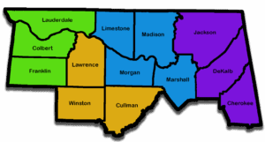
If you are considering a home around Fort Payne, add one realistic recreation trip to your area visit. Start from the actual address you are considering, use the vehicle you normally drive and include the return journey. Then think about how that trip fits beside groceries, work and the other parts of your week. A regional map can show proximity; it cannot decide whether an outing feels convenient to you.
For buyers, that exercise can sharpen a wish list beyond “near outdoor recreation.” Do you want a familiar short walk you can repeat, or are you happy reserving a larger part of Saturday for a scenic drive? For sellers, describe nearby destinations accurately and let buyers test the routes themselves. Avoid turning proximity into a promise about travel time, access or property value.
Featured photograph: autumn on Little River Canyon Rim Parkway, NPS / Matt Switzer, November 2019. It is an archival scene, not a report of current foliage or road conditions. No claim to original U.S. Government works. Photo source; NPS reuse information.
Final Thoughts: Build a Fort Payne routine you can actually enjoy
Outdoor access is most useful when it fits an ordinary week as well as a special outing. Try the destinations that interest you, check current conditions and think about the travel and preparation each visit requires. Those details help turn a place you enjoy visiting into a place you understand as a resident.
Want Personalized Real Estate Help?
Considering Fort Payne or another Northern Alabama community for your next home? I can help you compare your housing priorities with the everyday routines that matter to you. Contact me to talk through your next step.
Browse Fort Payne-area homes. Use the listings to build a shortlist, then test the routes to the specific outdoor destinations you would use; map proximity does not promise access or travel time.
Sharing is Caring:
Author