Jessica Hassan
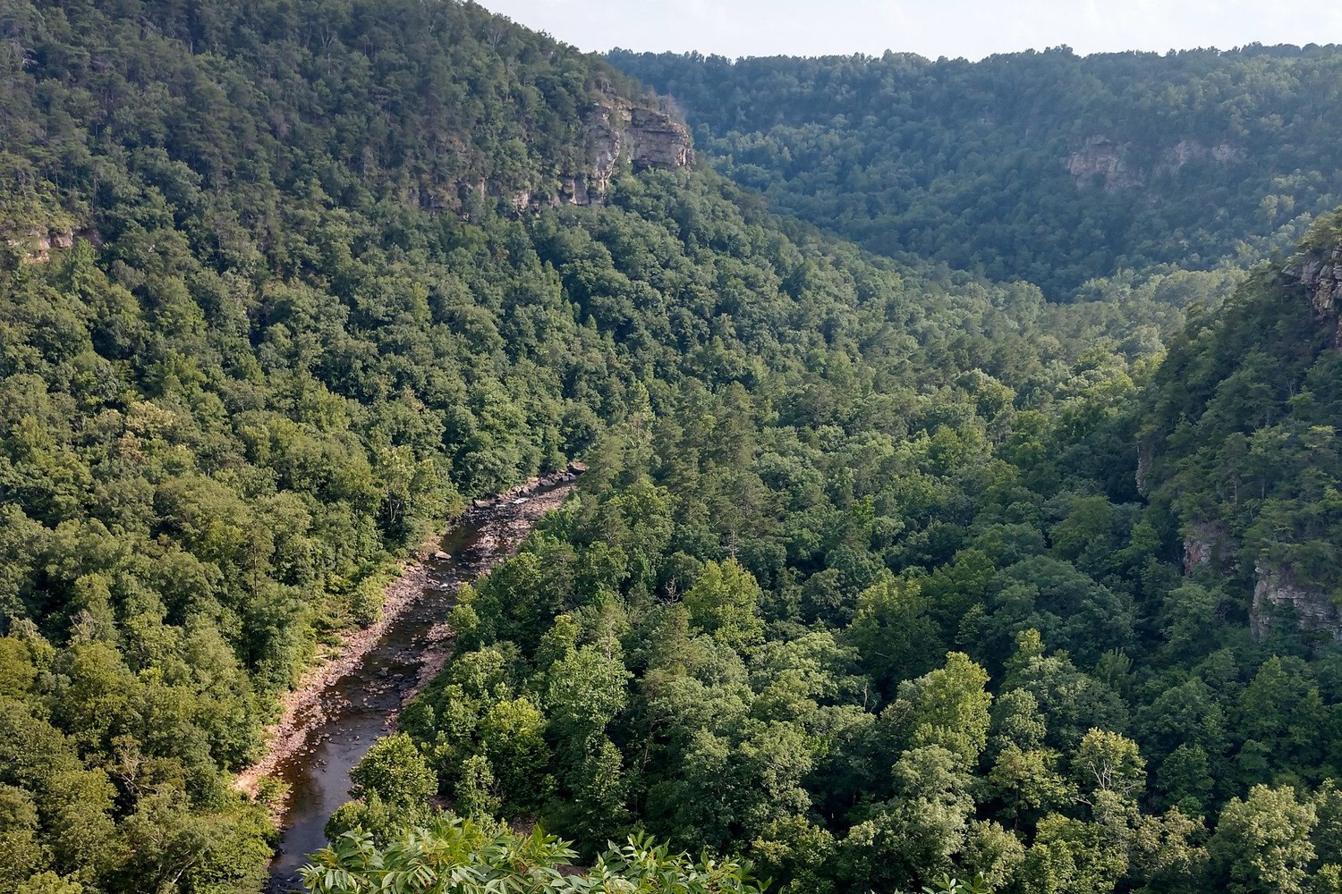
Little River Canyon can be a single-overlook detour, a daylight drive along the rim, or a longer trip toward Canyon Mouth Park. Those are different plans. The National Park Service gives a specific short return route and describes the developed rim parkway separately from the county-road continuation. Choose the turnaround before you leave Fort Payne, particularly if your vehicle is large or your daylight is limited.
Choose the turnaround before you drive
For a first visit, think in three tiers. The NPS scenic-drive directions describe the short option as about 30 minutes. That is a driving estimate, not a promise of time to park, walk, photograph or return to your starting point. The same page says the developed drive starts at Little River Falls Boardwalk and ends at Eberhart Point.
- Short overlook loop: Start from AL Hwy 35; turn off the parkway just after Canyon View Overlook onto CR 255. Return by Adamsburg Road. A sample of the canyon with a planned exit and time for a few pull-offs.
- Full rim parkway: Follow Highway 176 from Little River Falls toward Eberhart Point, about 11 miles and eight overlooks. More viewpoints and a slower, flexible daylight outing in a suitable vehicle.
- Continue to Canyon Mouth: From Eberhart Point, continue by Cherokee County Roads 148 and 275 only if vehicle restrictions and conditions allow. A separate lower-canyon trip; do not treat it as part of the easy 11-mile overlook drive.
The NPS Places to Go overview describes a roughly 23-mile connection from Little River Falls to Canyon Mouth Park and estimates approximately 45 minutes from the Canyon Center to Canyon Mouth without stops. The 23-mile figure is the extended corridor, not an 11-mile parkway with an extra dozen overlooks. Decide whether your goal is the rim viewpoints or the separate descent to Canyon Mouth; either way, allow additional time for stops.
See where the short loop leaves the rim
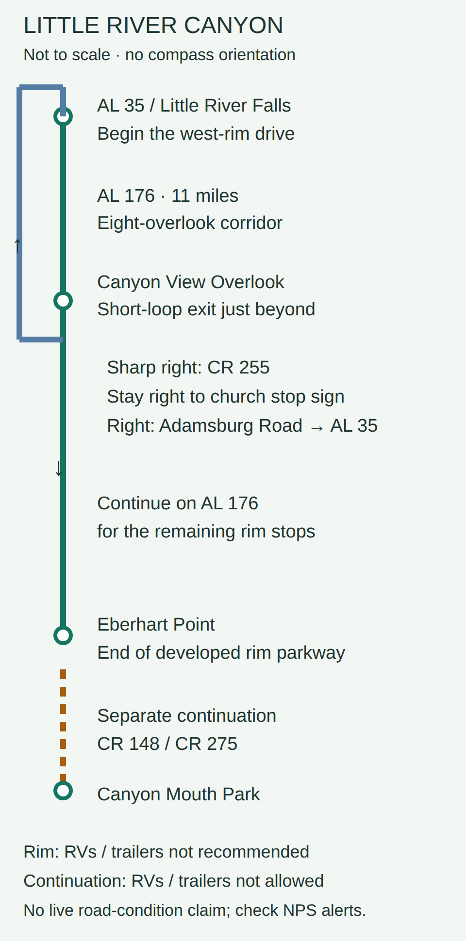
Route-choice schematic, not to scale. From Highway 35 and Little River Falls, Highway 176 follows the west rim to Eberhart Point, an 11-mile corridor with eight overlooks. For the short loop, leave just after Canyon View Overlook: sharp right onto County Road 255, stay right to the church stop sign, then right onto Adamsburg Road back to Highway 35. Eberhart ends the developed rim parkway. County Roads 148 and 275 continue separately toward Canyon Mouth Park. RVs and trailers are not recommended on the rim parkway and are not allowed on that continuation; motorcycles need extreme caution there.
Make the short loop deliberate
The short loop is more useful than simply turning around at the first view. From AL Highway 35, enter the parkway and use the NPS sequence of pull-offs. Just after Canyon View Overlook, turn sharply right onto County Road 255, stay right to the stop sign by the church, then turn right on Adamsburg Road to reach AL Highway 35. Read the official turn-by-turn description before departure and use current navigation for the actual drive. A 30-minute NPS estimate assumes little time outside the car.
The overlooks have pull-offs and require little walking for a view, according to NPS. That makes the loop a reasonable choice when someone in the group wants scenery without committing to a canyon trail. It does not mean every surface, platform or restroom has the same accessibility. Choose a particular stop after checking its NPS detail page and what the group needs.
Save the full rim drive for a flexible daylight outing
On the full rim parkway (Highway 176), eight overlooks create the value; the mileage alone does not. You can select stops instead of rushing to collect all of them. Crow Point shows the river bending below the rim, while Eberhart Point is the last improved overlook on the developed route. The NPS rim-parkway guide is the source for the 11-mile and eight-overlook figures. The NPS hours page currently lists the scenic drive and overlooks as open daily from sunrise to sunset with no fee. The 2026 NPS compendium gives Little River Falls parking lot a specific 7 a.m. opening, separate from the scenic drive’s general daylight hours. Check that page and current alerts and conditions again just before you go; this article does not certify that any road or overlook is open on your travel day.
If you continue beyond Eberhart Point, you are changing the trip. NPS identifies Cherokee County Roads 148 and 275 as the route toward Canyon Mouth Park, and its destination overview calls the 11 miles from Eberhart to Canyon Mouth steep and winding. Canyon Mouth Park has its own hours and day-use fee; consult the current fee and seasonal-hour listing before making it your endpoint.
Match the vehicle to the road
Highway 176 is narrow and curvy, with steep or blind hills and no shoulders. NPS says RVs and vehicles towing trailers are not recommended there. Its rule for the continuation is stronger: RVs and trailers are not allowed on the Cherokee County Roads 148/275 descent toward Canyon Mouth. Motorcycle riders should note the NPS warning about steep hills and loose gravel on sharp turns. Do not assume that a route suitable for a passenger car is suitable for every vehicle. Review the NPS vehicle guidance and current conditions before choosing the route.
Bicyclists also use the parkway. Drive at a pace that lets you see around curves and enter designated pull-offs safely; do not stop in the travel lane for a photograph. NPS says to watch for other vehicles, cyclists and wildlife. If weather, road work or an alert changes the plan, use the shorter route or postpone rather than improvising a turnaround on a narrow shoulder.
What a scenic visit can tell you about living near Fort Payne
A drive can help you understand the landscape and the sort of weekend you would actually repeat. It cannot establish the drive from a particular home, year-round road access, or a property right to reach the preserve. If you are comparing DeKalb County neighborhoods, test the real route from any home you are considering at the time of day you would use it. My Fort Payne outdoor-routine guide helps compare the canyon with other repeatable outings; this guide is specifically for choosing the scenic-drive length and vehicle plan.
Conclusion
Choose the short overlook loop when you want a quick canyon sample. Choose the full rim route when you can give its overlooks a daylight outing. Treat Canyon Mouth as an extension with different road restrictions, hours and fees. Recheck the NPS route and alerts immediately before driving. For a different waterfall outing with its own walking choices, see my DeSoto Falls viewpoint guide.
Want Personalized Real Estate Help?
If Fort Payne or nearby DeKalb County is on your home-search list, browse Fort Payne-area homes as a broad starting point. The search may show nearby communities; it does not certify park access, road suitability or a travel time from any listing. I can help you compare the actual routes and everyday priorities that matter to you. Contact me to discuss your plans.
Sharing is Caring:
Author