Jessica Hassan
A picnic near the Tennessee River can be a pleasant way to get to know the Cherokee area, but the parking choice at Colbert Ferry matters. The upper picnic area and lower boat-dock area do not offer the same route to a table, restroom or the water. Choose the part of the visit you want first, especially when stairs, uneven ground or a steep gangway would change the plan.
This is Cherokee in Colbert County, in the western Shoals—not Cherokee County in northeastern Alabama. The National Park Service identifies Colbert Ferry at milepost 327.3 on the Natchez Trace Parkway. Use that Google Maps search for orientation, then follow the park’s boat-ramp signs and choose the appropriate lot on arrival. A map pin does not describe the path you will take after parking.
Which parking area fits the visit?
For a picnic with restroom access, start by evaluating the upper area. For a dock visit, evaluate the lower area and the route beyond it separately. The NPS physical-access guide supplies these distinctions:
| Destination | Documented route detail | Planning consequence |
|---|---|---|
| Upper picnic area | Van-accessible parking by the picnic area; an accessible table on pavement. Other tables are on grass with roots and slopes. | Do not assume every table offers the same approach. |
| Restroom | Between the two lots, with an accessible space in front. From the lower lot, the route includes steep stairs. | Choose restroom access before carrying lunch downhill. |
| Lower boat-dock area | Accessible parking spaces are listed, but the access aisle has no curb ramp to the sidewalk. | A marked space alone does not establish a continuous route. |
For example, if a guest needs to avoid steps and the main plan is lunch, the upper picnic/restroom arrangement is the useful starting point—not a promise that every table will work. If someone else wants to see the dock, make that a separate optional activity. Everyone need not make the same trip down to the water for the picnic to feel complete.
The dock is a separate access decision
NPS describes a sidewalk-to-boardwalk route followed by a steep gangway to the floating dock. That last connection matters even after reaching the waterfront. The boat-ramp page has a broad accessibility amenity label; read it alongside the more specific route description rather than treating it as assurance that the entire visit is step-free.
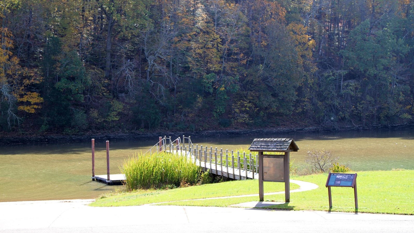
The photograph helps distinguish a boat ramp from the pedestrian approach to a dock. It does not show the entire parking-to-restroom journey. Use the access description to decide what to investigate, then describe the exact route you need when contacting the park. “Can I get from the upper picnic parking to a suitable table and restroom without stairs?” is more useful than asking whether the whole site is accessible.
Is the historic stand the same stop as the picnic area?
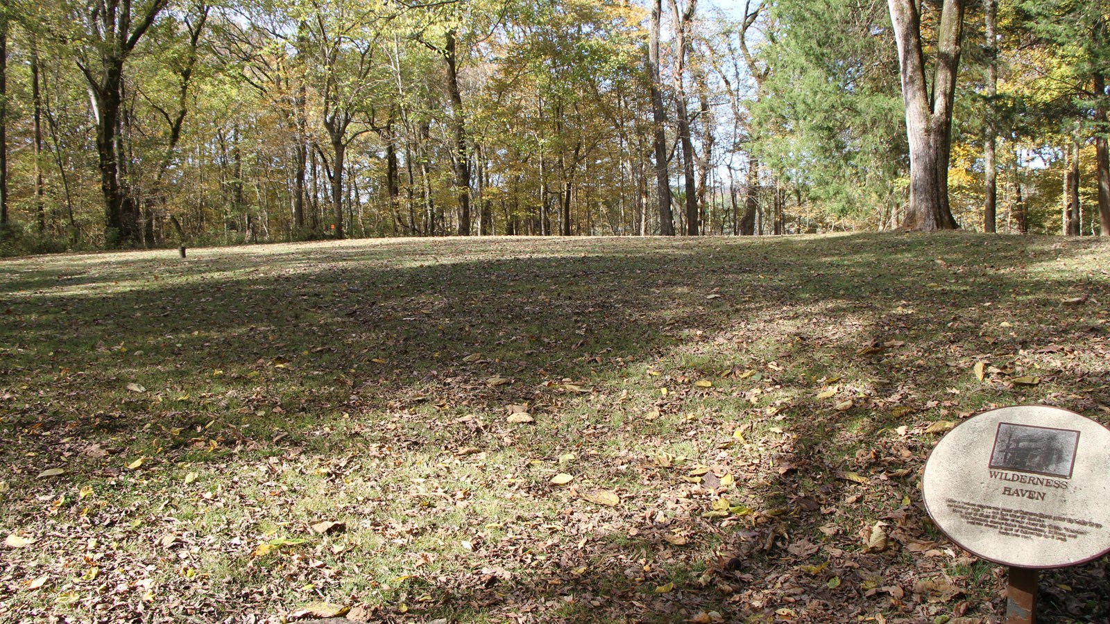
It is a different part of the Colbert Ferry site. A “stand” was an inn that provided travelers with food and lodging; the NPS stand-site page describes a walk up to the ridge where George Colbert’s home once stood. The featured photograph shows the clearing and interpretive sign, not an inn that you can enter today.
Keep that history walk optional in a riverfront lunch plan. The roadside name covers several features, and adding a ridge walk changes the outing. Do not infer an easy, level path from the word “short,” or use the stand’s parking information as a substitute for the picnic and dock routes above.
Turn the plan into a useful invitation
Tell companions which part of Colbert Ferry you mean: the upper picnic area, with a separate decision about visiting the dock or historic stand. Agree on the meeting point before people unload. Bring what you need for the meal, and keep the first outing focused enough that you can learn the layout without trying every feature.
Before setting out, read the current NPS road and site status. That is not a guarantee that every facility is available when you arrive. Old search results include a December 2021 paving closure; a dated archive should not be mistaken for today’s notice. For a route or facility question that affects your visit, the Parkway’s published visitor-information number is 662-680-4027.
If the plan grows from a casual picnic into a hosted gathering with a reserved shelter, my Joe Wheeler pavilion and admission guide answers a different Shoals-area question: budgeting a booked space and guest entry. Its reservation and admission arrangements should not be transferred to Colbert Ferry.
Access descriptions reviewed October 31, 2026; the detailed NPS mobility guide is dated June 2, 2025. Photos are credited to the National Park Service and show the physical setting, not current operating conditions. No claim to original U.S. Government works.
Conclusion: choose the route that supports the day
At Colbert Ferry, being close to the river and having a suitable path are different things. Match the parking area to the picnic, restroom or dock you actually intend to use, and keep extra walks optional. That gives a first visit a clear purpose and leaves you with a better sense of whether this Cherokee-area routine fits your everyday life.
Want Personalized Real Estate Help?
If you are considering a home around Cherokee, the places you would use on an ordinary free afternoon can help clarify your location priorities. I can help connect those preferences with property-specific questions as you buy, sell or relocate in the Shoals. Contact me to discuss your plans.
You can browse Cherokee-area homes while exploring the area. This is a geographic search, not a waterfront or park-access filter; compare each property’s actual location rather than assuming a short drive or public access from its listing.
Sharing is Caring:
Author

Sources and review notes
Context: Turn the plan into a useful invitationThe page reviewed October 31, 2026 was updated October 30 and did not list a Colbert Ferry closure.