Jessica Hassan
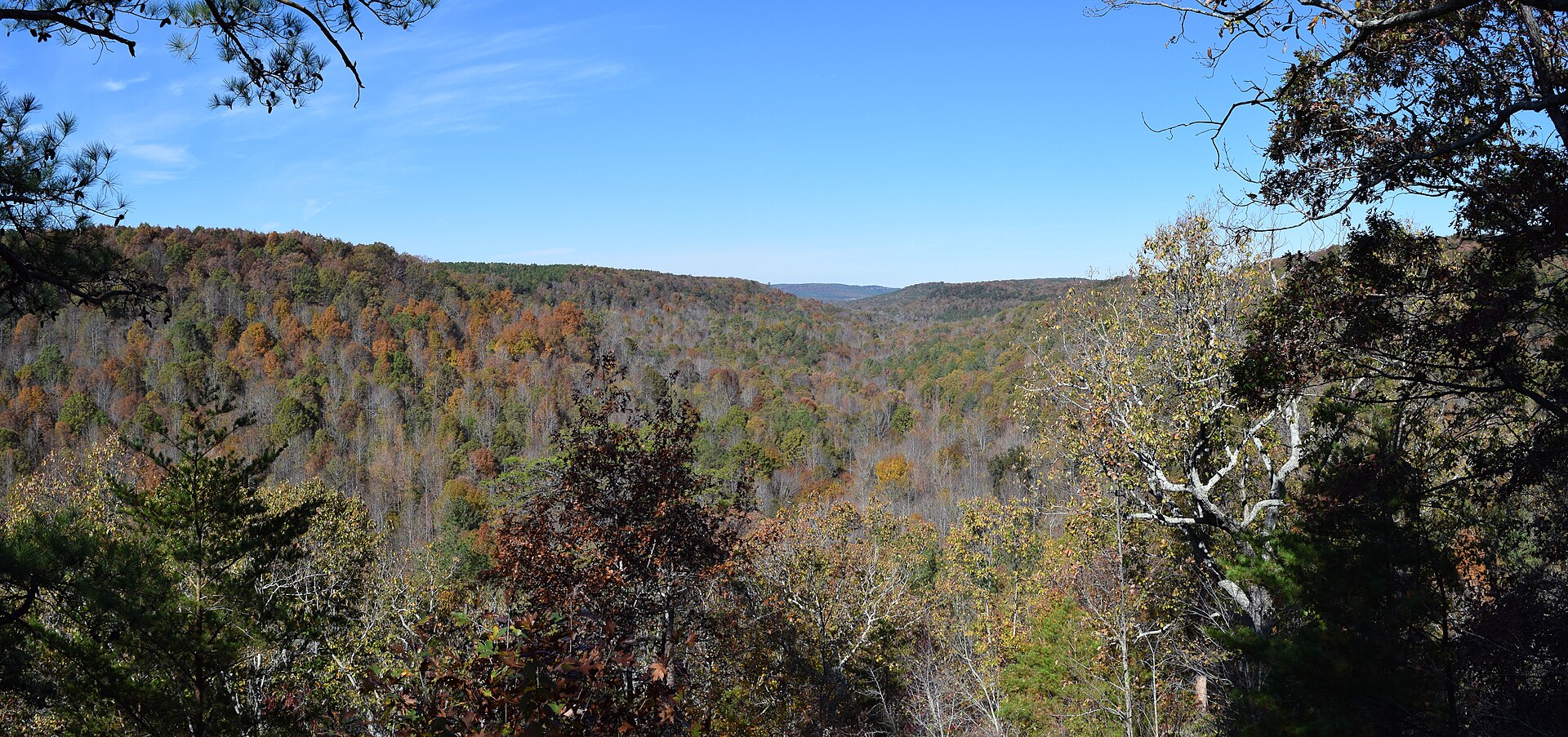
At Cane Creek Canyon Nature Preserve in Colbert County, southwest of Tuscumbia, the most useful first decision is how much of the canyon your group wants to take on. A picnic near the trailhead and a hike down to creek level are very different commitments. Plan the return uphill before choosing the view you want to reach.
For newcomers exploring the Shoals, I would give this outing its own space in the weekend rather than squeeze a canyon descent between other appointments. Start with the people coming along, then work backward from closing time.
Stay near the trailhead or descend into the canyon?
The Land Trust’s preserve guide describes an easily reached picnic area just off the trailhead. Beyond it, descending trails can be difficult for visitors with knee, back or stamina concerns. Here is the practical choice:
| Visit style | What you are choosing | How to shape the day |
|---|---|---|
| Trailhead-area picnic | Remain near the arrival area instead of committing to creek level. | Make lunch and time outdoors the purpose; leave the descent optional. |
| Canyon descent | Approximately 350 feet of elevation change between ridge and creek; the operator rates the descent moderate. | Keep enough energy and time to climb back out, including rests. |
For a ridge-to-creek-and-back outing, the return reverses that vertical difference. The 350-foot figure is neither the walking distance nor a measurement of every rise along your chosen route. A moderate rating also does not tell you how a particular knee or back will feel on the way home. If the climb is the sticking point, the picnic can be the whole visit, not a consolation prize. The operator’s description is not a certification of a step-free route.
Work backward from 4:30, not from sunset
As checked November 2, 2026, the current preserve page lists Friday–Sunday hours of 7:30 a.m.–4:30 p.m., with trail access limited after 3 p.m. It also lists major-holiday opening except Thanksgiving Day and Christmas Day. All times here are local to the preserve.
For example, a hypothetical 2:30 p.m. arrival leaves two hours until closing and only half an hour before the stated access limitation. That arithmetic is not permission to begin a canyon hike or a suggested hiking duration. For a first descent, an earlier arrival leaves more room to choose a route, pause and return without turning the climb into a race.
There is a real source mismatch worth noticing: the downloadable June 2024 trail map still prints 7 a.m.–5 p.m. Its route information is useful, but use the current preserve page for the operating window. The Land Trust’s general dawn-to-dusk statement should not replace Cane Creek’s specific hours. The current page does not explain exactly which trails remain available after 3; resolve that with on-site staff rather than assuming it means unrestricted entry until closing.
Read the map as a network, not a ready-made loop
The map lists 25.7 miles across the trail network. That is not the length of one recommended hike. Its legend gives individual trail lengths, including Waterfall Trail at 0.35 mile and Cane Creek Trail at 1.75 miles. Neither number, by itself, includes every connection and return needed for your outing.
Before leaving the station, trace the complete route back to your car and identify the junction where you will turn around or start returning. A named waterfall is a destination, not a complete itinerary. Download the operator-linked trail map before the trip; the Land Trust’s hiking tips also recommend a paper backup. No single loop, hiking time or accessible overlook route is promised here.
The north entrance still starts with main-entrance check-in
The published main trailhead is 251 Loop Road, Tuscumbia, AL 35674. The preserve’s sign-in instructions require arrival check-in at the visitor support station beside main parking. For north-entrance access, request a dashboard parking permit there, drive around to the north entrance, then return the permit before leaving. Avoid the private residence beside the main entrance.
So choose the north entrance for a route you have planned with the map and staff, not as a way to skip check-in or the return arrangements. A second access point does not establish an easier hike. Keep time for the drive-around and permit return; no driving duration or independent north-entrance address is supplied here.
When the canyon plan should change
The Land Trust’s rules say to stay off wet trails for 24 hours after rainfall, remain on marked trails and keep pets leashed. When designated trailhead parking is full, the preserve is closed to additional visitors; street parking or an undesignated space is not a fallback. Camping, fires and drones are prohibited. Read any property-specific signs on arrival.
A wet-trail day or a group that wants a meal without a canyon descent calls for a different plan, not a workaround. If a riverfront picnic better matches your interests, my Colbert Ferry parking and picnic guide explains its separate upper-picnic and lower-dock approaches. It is another Colbert County outing with its own access questions, not a guaranteed level substitute or a same-day connection.
Conclusion: save something for the climb home
A satisfying first visit can stop near the trailhead or continue into the canyon. The better choice is the one your group can finish comfortably within the actual opening window. Settle the full return route and any north-parking permit arrangements before heading down. Reaching the creek is the middle of that plan, not the finish.
Want Personalized Real Estate Help?
If getting to know the Shoals through places like Cane Creek Canyon is part of your move, I can help you connect those weekend preferences with your everyday housing priorities. You can browse homes in Tuscumbia and the surrounding Shoals area as a starting point. This broader area search can include neighboring communities; it is not a distance-to-preserve or trail-access filter. Contact me to talk through the location and property details that matter to you.
Sharing is Caring:
Author

Sources and review notes
Featured photograph: Cane Creek Canyon viewed from the Point, October 30, 2015. Fredlyfish4 / Wikimedia Commons, CC BY-SA 4.0; Wikimedia’s resized rendition, otherwise unchanged. This historical landscape photograph does not show today’s trail conditions or the full return route.